Map Tile Servers
| Date Published: | |
| Last Modified: |
Overview
Map tile servers are web servers which have an API for returning tiles of map imagery. Most web and mobile applications (think Google maps) which provide map services do not download or store a copy of all the map data, due to the huge file sizes, latencies and data caps. Instead, as a user pans and zooms on a map, requests for square tiles of map imagery at the users current zoom level (resolution) and area-of-interest (AOI )are sent out by the user application to the map server. The map server either has pre-rendered, cached copies of these tiles or renders them on-the-fly, compresses them, and sends them back to the user (the server typically sends back compressed .png or .jpeg files). The map application inserts these tiles into the map to provide a seamless browsing experience to the user.
Typically WGS84 Web Mercator (EPSG:3857).
https://a.tiles.maps.eox.at/wmts/1.0.0/s2cloudless-2017_3857/default/g/1/1/1.jpg returns this tile:
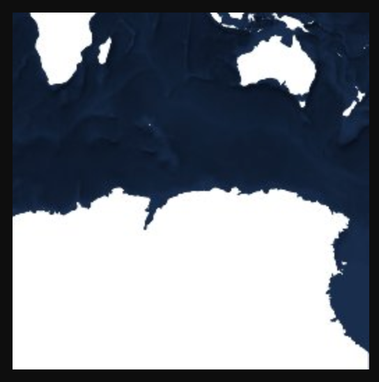
The tile returned from a Web Map Tile Service (WMTS) at the URL https://tiles.maps.eox.at/wmts/1.0.0/s2cloudless-2017_3857/default/g/1/1/1.jpg
Standards
Tile Map Service (TMS)
Web Map Tile Service (WMTS)
The Web Map Tile Service (WMTS) is a newer, more feature-full standard than the Tile Map Service. The WMTS standard is specified by OGC.
The simpler OGC WMTS Simple Profile.
Capabilities defined in a machine-readable XML format. See https://tiles.maps.eox.at/wmts/1.0.0/WMTSCapabilities.xml for an example.
gdal has built-in support for using WMTS (see https://gdal.org/drivers/raster/wmts.html).
The
Authors


This work is licensed under a Creative Commons Attribution 4.0 International License .
Related Content:
Tags
- space
- map tile servers
- gdal
- OGC
- geospatial
- web server
- ArcGIS
- png
- web mercator
- WMTS
- Web Map Tile Service
- TMS
- Tile Map Service